Seascape change begins
Although whalers and sealers were active in Bass Strait from 1798, the first recorded European entry to Port Phillip Bay was by Lieutenant John Murray on the Lady Nelson on 14 February 1802. Matthew Flinders followed 10 weeks later. However, the rapid rise of agriculture and resource extraction in the Colony of Victoria only began with the arrival of John Batman in 1835.
At the time, Swan Bay’s catchment was covered by grassy woodland with Manna Gum, Drooping Sheoak, Black Wattle, Golden Wattle, Black Sheoak, Silver Banksia and Coast Banksia. It soon disappeared as the Bellarine Peninsula was caught up in the demand for food, timber and other resources. Today, only three per cent of the catchment’s original vegetation remains.
Catchment clearing
The tanning of leather was a major industry in early Melbourne and required large amounts of tannin sourced from the bark of wattles and sheoaks. The bark was stripped from the trees and the trees then cut for firewood to fuel the city’s expanding bakeries.
In Swan Bay, corrugated timber ‘roads’ were laid in the water to load small boats that transported the bark to larger barges offshore for shipment to Melbourne.
Fishing
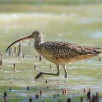
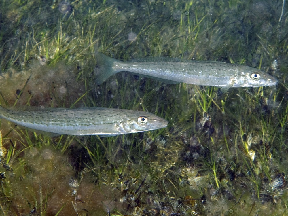
Commercial fishing began in Queenscliff in the 1860s with up to 130 fishers. When weather in Port Phillip Bay and Bass Strait was unfavourable, King George Whiting, Flathead, Snapper, Flounder and other fish were harvested from small fishing boats in Swan Bay. The bay was recognised as an important fish nursery and catches were regulated for its protection.
A ban on net fishing was declared in 1870 but lifted a year later after protests and illegal fishing. In 1896 net fishing was again banned, however some illegal netting continued. Fish were not the only natural resources harvested in Swan Bay. Seagrass was used to insulate local houses and public buildings. Guano, which is the build-up of seabird droppings, was mined on Duck Island for 20 years.
Swan Island Fort, golfing and sailing
In the early years of Queenscliff’s development, Swan Island was used for livestock grazing. However, in 1879 the Colony of Victoria purchased the land and began construction of the Swan Island Fort. This was in response to concerns about an invasion by Russia. The Swan Island Fort, gun emplacements and magazine, which cover about 140 hectares, were completed in 1894. After federation in 1901, Swan Island was transferred to the new Commonwealth Government. By that time, the fort was inadequate for engaging modern warships and has since been used as a training facility for defence personnel.
People have been playing golf on Swan Island since 1907. The course began with five holes but was later extended to 12, 15 and finally its current 18. Golfers share the fairways with Eastern Grey Kangaroos and might be lucky to see the Orange-bellied Parrot on its annual visit to Swan Bay. The Queenscliff Cruising Yacht Club was established in 1963 on a sandy spit facing Port Phillip Bay. However, the bay is now 400 metres away due to the formation of Sand Island with dredge spoil from Queenscliff Harbour.
Access to Swan Island is via a bridge and causeway that connects Swan Island to Queenscliff via Rabbit Island. Only those people who are defence personnel, hold a permit or are members of the Queenscliff Golf Club or Queenscliff Cruising Yacht Club can visit the island.
Waste disposal
From 1900 Tip Island was used as a dump for household rubbish, refuse and garbage. A limestone causeway, now submerged, was built to connect the island with Burnt Point. Rubbish was also dumped over the side of the cliffs between the Queenscliff Railway Station and the Queenscliff Lonsdale Yacht Club. There is also an old tip site at the corner of Murray and Fellows roads.
From the 1930s to the 1970s the current site of the Marine Discovery Centre was used as a council waste transfer station. Use of the station caused litter and water pollution issues and impacted the condition of soil and groundwater.
‘The Cut’ and harbour dredging
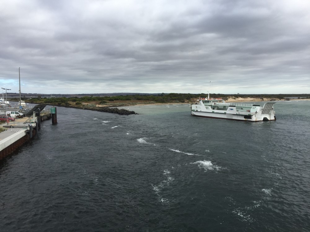
Swan Island was separated from the Queenscliff mainland by a narrow and meandering channel that prevented reliable boat access to Swan Bay. In 1937 a channel was dredged to form a permanent entrance known locally as ‘The Cut’. The speed and volume of the tidal flow increased, with sand now carried into Swan Bay where it is shallowing the southern section.
Expansion of the Queenscliff Harbour has required dredging, with the dredge spoil being dumped to the north of training walls. This has created Sand Island, which is now an important roosting and nesting site for gulls and terns.
Shell grit mining
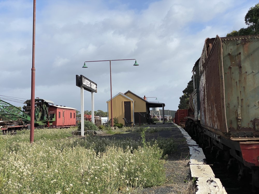
Shell grit mining at Lakers Cutting between 1955 and 1973 removed 120,000m3 of material that produced 32,000m3 of shell grit used to make glass, feed poultry and construct pathways.
Before mining, the land was covered in coastal saltmarsh. The removal of the shell grit allowed the waters of Swan Bay to spill across the area along Murray Road to Fellows Road. The mining company was called Lakers and the new waters called Lakers Cutting. The Queenscliff railway line was reopened to cater for the industry and carried about 1000 tonnes of shell grit each week from the Lakers Siding. The company’s extraction licence was cancelled in 1973 and the railway line closed three years later. Seagrass meadows now cover the area but Lakers Cutting is not in the marine national park.
PHOTO CREDITS